Joint Venture
OMM contributes the licence(s), partner contributes capital and operating capability. Standard mining-industry JV structure with operator appointment, governance, and exit clauses.
— Where We Operate —
From exploration toward a mining-stage title in the Borgu gold belt
Flagship Exploration Licence EL68022 in Borgu LGA, Niger State — with a Small-Scale Mining Lease application filed over its highest-priority ground.
Exploration Licence EL68022, Borgu LGA, Niger State — granted 13 October 2025.
13.2 km² of exploration ground under EL68022, in a proven gold belt with producing neighbours.
Mining-stage lease application filed over the highest-priority gold quadrant, carved from EL68022.
Incorporated 2018 (RC 1520962); under new ownership since October 2024.
— Flagship Project —
Our flagship project. EL68022 sits in a proven gold belt surrounded by producing small-scale and large-scale operations. The site has confirmed gold-bearing surface mineralisation from historical artisanal workings, with multiple coarse-gold and nugget occurrences documented in soil and stream-sediment sampling.
— The Ground, Visualised —
This is EL68022 as it exists at the Mining Cadastre Office — every line below is drawn from the coordinate schedule of the grant document, not an artist's impression.
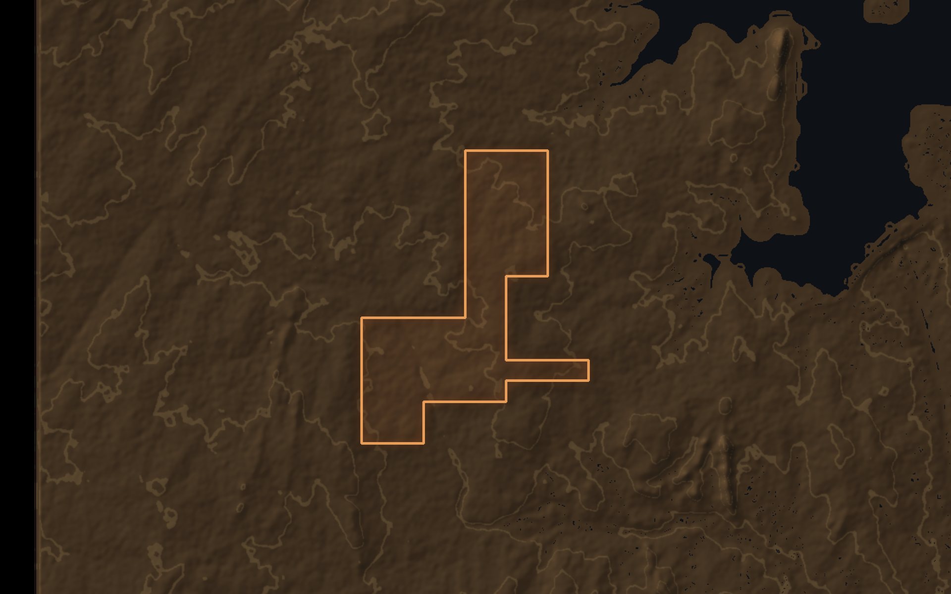
Geometry from the MCO grant coordinate schedule (15″ cadastral grid). The 4-CU SSML application quadrant sits within this licence; its exact cells will be published if and when the lease is granted.
Systematic surface work across all 66 units identified one standout gold quadrant — those 4 units are now under a Small-Scale Mining Lease application, and exploration continues across the remaining ground.
— Mining-Stage Application —
The application covers EL68022's highest-priority gold quadrant, selected from systematic surface work across the licence. Filing for a mining-stage title on our own ground is a deliberate commitment: the target was good enough to stake the next stage on. Grant status will be updated here once the Mining Cadastre Office decides.
Reconnaissance surveys over target areas in Ondo State were completed in late 2025, with geologist field reports and budgeted, closed-out field missions. Target assessment is ongoing; new titles will be announced here if and when granted.
We list only titles we hold and work we have actually done. Licence numbers and grant documents are verifiable at the Nigerian Mining Cadastre Office and are shared with qualified counterparties under NDA.

We engage with capital, technical partners, and strategic investors in three principal structures. Specifics are confidential and developed against the counterparty's mandate and the project's stage.
OMM contributes the licence(s), partner contributes capital and operating capability. Standard mining-industry JV structure with operator appointment, governance, and exit clauses.
Counterparty funds exploration in exchange for a Net Smelter Return (NSR) or gross-revenue stream on production. OMM retains title and operational involvement; partner earns a passive return.
For counterparties who want full control and are prepared to pay a premium for the licence package, ongoing disclosure obligations, and our exit from the licence area.
Site maps, soil-sample data summaries, structural interpretations, and the SSML application pack are available to qualified counterparties under NDA.